As of Monday, it was still easy to find snow banks along Highway 218 taller than a car. Rural roadside ditches throughout north-central Iowa are filled with snow.
The landscape is going to change beginning Tuesday as an abnormal warm-up will jumpstart a meltdown, and create dangerous situations.
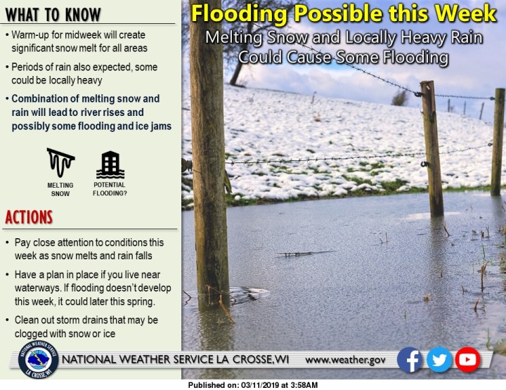
The National Weather Service is warning about flooding and more as heat rises and rain falls through the rest of the week.
It’s warning reads that “significant and prolonged warmup from Tuesday afternoon through Thursday is going to start the snow melt across the area in the upcoming days.
“Snow cover across parts of northeast Iowa and far southwest Wisconsin is ready to quickly melt and run off … In cities and towns, the effects of snow melt and run off will be quicker and more easily noticeable if storm drains and drainage
ways are clogged by snow and ice. Ponding of water in
intersections and low areas may quickly develop in many communities.
“On top of this, periods of rain are expected late Tuesday through
Thursday, with rainfall totals of around an inch possible for
many locations. This will add to the snow melt run off and flooding threats.
“With ice on most rivers and streams, there is also the threat of ice jams and the flooding that comes with them as rivers and streams rise from the snow melt and rain fall run-off.”
The weather service issued a flood watch for Floyd and surrounding counties for Wednesday and Thursday.
A spring flooding outlook issued by the weather service last week warns that this week’s threat won’t stand alone. It states their is an above to well-above normal flood risk for the spring along the main-stem Mississippi River and most of its tributaries across northeast Iowa.
Contributing factors include: expansive snow cover across the region, 2-4 inches of water in that snow, thick river ice, persistent higher-than-normal flows this winter, and saturated soils due to a very wet fall, the outlook states.